ניסן לברון *
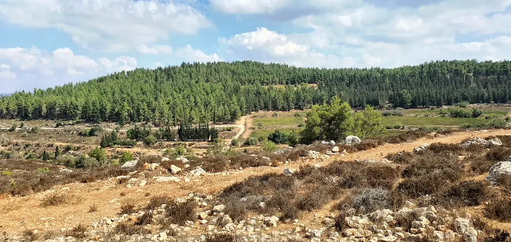
מי היה מאמין שתחת שם כמו "הר רפאים" מסתתרת שמורת טבע יפה – עם ממצאים מרשימים מההיסטוריה היהודית? לפניכם תוצאותיהם של סיורים שערכתי שם בתמונה למעלה: מבט אל הר רפאים, המכוסה בעצים ירוקי-עד.
For English please see at the bottom of this post
הר רפאים נמצא ליד מבוא ביתר, דרומית לירושלים. ההר קיבל את שמו בשל נחל רפאים שערוצו עובר לידו. תחילתו של נחל זה בירושלים, באזור הנקרא עמק רפאים המוזכר בספר יהושע (יח, טז): "וְיָרַד הַגְּבוּל אֶל קְצֵה הָהָר אֲשֶׁר עַל פְּנֵי גֵּי בֶן הִנֹּם אֲשֶׁר בְּעֵמֶק רְפָאִים צָפוֹנָה". ההר וסביבתו יפים מאוד למראה. הם מכוסים בעצים ירוקים, ומספר פעמים ראיתי צבי ארץ ישראלי מדלג ביניהם. המטייל במקום נהנה מהנוף הנפלא, מהאוויר הצח ומהשקט. למרגלות ההר משתרע עמק רחב שבו מגדלים ענבים, חבושים, אגסים ותאנים. ששה מעיינות נמצאים בסמוך:
- עֵין מִסְלָע
- עֵין מִנְּהַר
- עֵין יוֹאֵל
- עֵין עָפְרָה
- עֵין אֶל בַּיָּד
- עֵין קוֹבִּי
שלושה מאלה נובעים עד היום, ואחרי עונת הגשמים אפשר לטבול או להשתכשך במימיהם. המעיינות והאדמה הפורייה משכו במרוצת הדורות בני אדם לקבוע את מגוריהם בהר רפאים, ועד היום ניתן לראות בו שפע שרידים מתקופות קדומות. בתקופת בית המקדש הראשון והשני ובימי המשנה והתלמוד התקיימו באזור זה יישובים יהודיים חשובים. לדוגמה:
- חורבת טוּרָה, המזוהה כהעיר החשמונאית טוּר שמעון שעליה נכתב בתלמוד: "טוּר שִׁמְעוֹן לָמָּה חָרַב? אָמַר רַב הוּנָא: מִשּׁוּם שֶׁהָיוּ מְשַׂחֲקִים בְּכַּדּוּר". (ירושלמי תענית, ד, ה).
- ביתר העתיקה, שהייתה עיר גדולה בה התקיימו חיים יהודיים ענפים. בתלמוד מובא כי "אַרְבַּע מֵאוֹת בָּתֵּי כְנֵסִיּוֹת הָיוּ בִּכְרַךְ בֵּיתָר" (גיטין נח, ע"א).
- כפר צוּם, בו נחשפו שני מקוואות טהרה משוכללים.
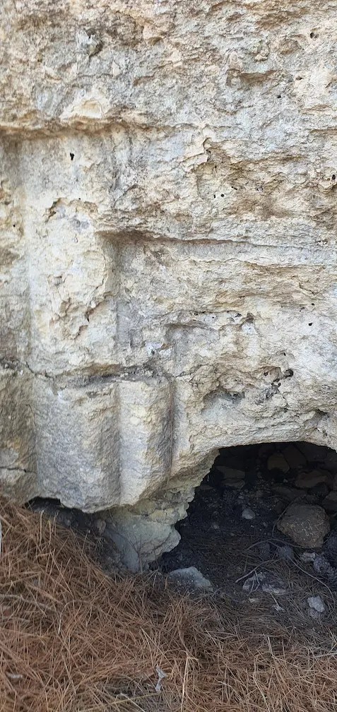
לא פלא, אפוא, שגם בהר רפאים יש סימנים למגורי יהודים בעת העתיקה. נראה אותם להלן. המקום אינו מוכר לציבור המטיילים, ויהודים מגיעים לאזור בעיקר בימי חג וחופש. רועי צאן בני מיעוטים נמצאים כאן לפעמים ולכן מומלץ לטייל כאן רק בשני אנשים ויותר. מידע מוקדם על האזור קיבלתי מ"סקר נס הרים" שערכו פרופ' בועז זיסו ועמיתיו, ומסקר "דרום-מערב הרי ירושלים" של מכון דש"א, 2018. לפניכם תמונות שצילמתי בהר רפאים בשנת תשפ"ב. התמונות מותרות בהעתקה בציון שם הצלם: ניסן לברון.


 גדלים ליד הר רפאים. כשהוא בשל אפשר לאכול אותו וטעמו מזכיר את האגס התרבותי")


")


 מעצי המקום שנבנתה בזמננו במרכזו של הר רפאים")


. בהר רפאים מצאתי כעשר שומרות")

New discoveries on Mount Rephaim
Nissan Levron
Who would believe that Mount Rephaim, which means "Ghost Mountain" in Hebrew, is home to a beautiful nature reserve with impressive findings from Jewish history?
In the summer of 2022 I toured this relatively unexplored mountain near Mevo Betar.
Mount Rephaim got its name from Nachal Rephaim, whose riverbed runs next to it. The source of this stream is in Jerusalem, in Emek (the valley of) Rephaim mentioned in the book of Joshua (18:16):
"And the border went down to the edge of the mountain, which is on the face of Gey ben Hinnom, which is in the valley of Rephaim towards north".
The mountain and its surroundings are very beautiful. They are covered with green trees, with gazelles jumping among them. The hiker enjoys a wonderful view, fresh air and silence. At the foot of the mountain stretches a valley where grapes, quinces, pears and figs grow. The trees come from cultivated orchards in ancient times which still bear fruit. Seven small springs existed in the area:
- Ein Misla
- Ein Minhar
- Ein Yoel
- Ein Ofra
- Ein El Bayd
- Ein Koby
Three of these continue to flow to this day, and after the winter rains you can dip or wade in their waters.
Over the generations, the springs and the fertile soil have attracted people to settle in Mount Rephaim. One can see many remains here from ancient times, including signs of Jewish residence, as we see in some of the photographs here.
During the time of the First and Second Temples, as well as during the days of the Mishnah and the Talmud, several Jewish settlements were built near the mountain. Among them:
- Ancient Betar, which was a large city where a vibrant Jewish life existed. In the Talmud it is stated that "four hundred synagogues were in the city of Betar" (Gittin 58, 11).
- Churvat Tura, which is identified as the Hasmonean city of Tur Shimon, about which it is written in the Talmud: "Why was Tur Shimon demolished? Rabbi Huna said: Because it's inhabitants were playing ball on Shabbat." (Yerushalmi Tanit, 4, 5).
- Kfar Tsum, where two sophisticated mikvahs were found.
Jewish hikers come to the area mainly on vacation days and chol hamoed, and there is a some presence of Bedouin shepherds, so it is recommended to come in a group of two or more.
I obtained information about the archeology of the area from the Nes Harim Survey conducted by Prof. Boaz Zissu and his colleagues in the early 2000's, and from The Southwest Jerusalem Mountains Survey of the Deshe Institute, 2018.
Above are photos that I took at Mount Rephaim.
All photos may be reproduced for non-commercial purposes and with the following credit: Photo: Nissan Levron


כתיבת תגובה